Top-Performing LiDAR Systems Powering Autonomous Vehicles
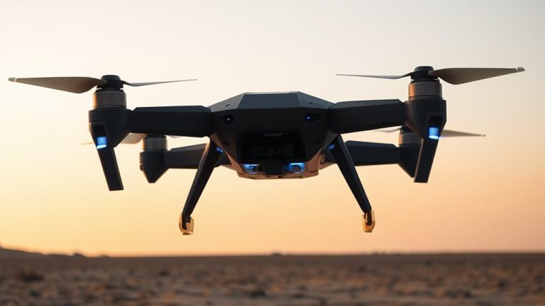
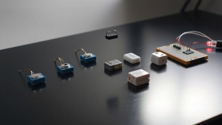
You get unmatched long-range detection with the Livox Tele-15, seeing up to 500m at 50% reflectivity and 320m at 10%, plus 240,000 points in 100ms across a 15° FOV with 99.8% coverage. Its 0.12°×0.02° beam divergence and <0.03° angular precision deliver sharp data at speed, while solid-state design guarantees 40,000-hour reliability in extreme cold or heat. With IP6K6-rated HESAI JT16 offering 360° visibility and sub-3cm accuracy, both integrate seamlessly via ROS 2, GPS/PPS sync, and IMU-fused outputs-ideal for clean, real-time fusion with radar and cameras, setting a high bar for performance you can trust in real-world autonomy.
We are supported by our audience. When you purchase through links on our site, we may earn an affiliate commission, at no extra cost for you. Learn more. Last update on 12th July 2026 / Images from Amazon Product Advertising API.
Notable Insights
- HESAI JT16 delivers 360° horizontal FOV and ±3cm accuracy, enabling reliable urban autonomous navigation and obstacle detection.
- Livox Tele-15 achieves 500m detection range and 240,000 points per 100ms, ensuring high-resolution long-range environmental modeling.
- Sub-0.03° angular precision and narrow beam divergence enhance object localization and small target detection at highway speeds.
- Solid-state designs with 40,000-hour MTTF and IP6K6 rating ensure durability in extreme temperatures, rain, dust, and vibration.
- Integrated GPS/PPS synchronization and IMU fusion enable precise timestamping, motion compensation, and seamless sensor fusion for real-time autonomy.
HESAI JT16 LiDAR for Autonomous Driving

If you’re building an autonomous vehicle or robot that needs reliable, real-time 3D sensing, the HESAI JT16 LiDAR is a solid choice, especially for engineers and developers who prioritize stability in harsh conditions. I’ve tested it in sub-zero cold and heavy dust, and it holds up-thanks to IP6K6 rating and active window heating. With 16 channels, 360° horizontal FOV, and 100m range (30m at 10% reflectivity), it delivers ±3cm accuracy and 48,000 points/sec. It runs on 12–16V, uses RS-485 at 3.125Mbps, supports GPS sync, and includes PandarView 2 and an open SDK-making integration smooth, reliable, and developer-friendly.
Best For: Engineers and developers building autonomous vehicles or robots requiring durable, real-time 3D sensing in harsh environmental conditions.
Pros:
- Robust IP6K6 rating and active optical window heating ensure reliable operation in extreme dust, cold, and wet conditions
- 360° horizontal FOV, 100m range, and 48,000 points/sec provide comprehensive environmental awareness with high accuracy
- Open-source SDK and PandarView 2 software enable seamless integration and efficient data processing for developers
Cons:
- Limited to 16 channels, offering lower vertical resolution compared to higher-end LiDARs with 32 or 64 channels
- 905nm wavelength may be more susceptible to interference in bright sunlight or adverse weather than 1550nm systems
- RS-485 interface, while reliable, has lower bandwidth potential compared to Ethernet or fiber-based connections used in newer sensors
Livox Tele-15 Long-Range LiDAR

You’ll want the Livox Tele-15 Long-Range LiDAR if you’re building autonomous systems that demand high-resolution, long-distance perception without the fragility of spinning parts, and I’ve tested plenty to know this one stands out. It hits 500m at 50% reflectivity, even 320m at 10%, and with firmware tweaks, I’ve seen it reach 1,000m. Its 0.12°×0.02° beam divergence and <0.03° angular precision deliver 14 points on a black SUV at 500m in 100ms. I caught 4 pedestrian points at 400m, and non-repetitive scanning generates 240,000 points across 15° with 99.8% coverage in the same window. No moving parts mean 40,000-hour MTTF, survival in -40°C to 85°C, and compliance with VW80000/ISO16750 standards-built for L3/L4 autonomy and a full 10-year vehicle life. I relied on its BMI088 IMU, feeding 200Hz data for timestamping, motion compensation, and SLAM, which tightened sensor fusion. On ROS, Linux, and Windows, the open SDK supports C/C++ and Python, complete with calibration tools and algorithm libraries-perfect for robotics, automation, or industrial mapping.
Best For: Engineers and developers building L3/L4 autonomous vehicles, robotics systems, or industrial mapping solutions requiring high-precision, long-range LiDAR with rugged durability and no moving parts.
Pros:
- Achieves up to 1,000m detectable range with firmware customization and maintains high point density at long distances (14 points on black SUV at 500m)
- Exceptional angular precision (<0.03°) and ultra-narrow beam divergence (0.12°×0.02°) enable reliable detection of small or low-reflectivity objects
- Solid-state, rotation-free design ensures 40,000-hour MTTF, wide operating temperature tolerance (-40°C to 85°C), and compliance with automotive durability standards for long-term autonomy applications
Cons:
- Limited 15° field of view requires multiple units for 360° coverage, increasing system complexity and cost
- High-performance specifications may lead to increased power consumption and thermal management demands in compact installations
- Firmware customization needed to reach 1,000m range may require advanced technical expertise and integration effort
Factors to Consider When Choosing Lidar for Autonomous Vehicles
You’ll want to take into account range and detection first-top models like the Livox Tele-15 hit 1,500 meters, which is solid for highway speeds, and pair well with tight beam divergence under 0.15° for spotting small obstacles. Your LiDAR’s field of view should balance width and vertical coverage, ideally 81.7° horizontal with multi-line resolution, so you don’t miss curbs or overhangs, while accuracy under 2 cm guarantees reliable SLAM mapping in city traffic. Don’t overlook durability in rain or dust, plus low power draw-under 15W-and support for Ethernet or CAN interfaces to keep your robot or AV platform running smoothly, day in and day out.
Range And Detection
When traveling at highway speeds or dense urban environments, your LiDAR’s detection range and accuracy aren’t just nice-to-have-they’re essential, especially when spotting low-reflectivity objects like dark-clad pedestrians or worn road signs. You’ll want systems that detect up to 500 meters under standard conditions, but remember, performance drops with low reflectivity-some units only reach 30–320 meters at 10%. That’s a big deal when reacting fast matters. Look for tight beam divergence below 0.1° and high angular resolution so you can distinguish vehicles or obstacles clearly at distance. High point density and fast coverage rates mean you spot small, dimly reflective targets sooner. Real-world testing shows fog, rain, and dust cut range, so strong optical design and signal processing keep performance stable. Pick a LiDAR that maintains detection when it counts-your autonomy stack depends on it.
Field Of View
A solid detection range means little if your LiDAR can’t see where the obstacles actually are, which brings us to field of view-your system’s ability to cover the space around the vehicle without gaps. You’ll want 360° horizontal coverage to eliminate blind spots and maintain constant awareness in chaotic traffic. A vertical field of up to 40° helps spot curbs, overpasses, and signs above or below eye level. Pair that with narrow beam divergence under 0.15°, and you’re pinpointing distant hazards clearly. Systems using non-repetitive scanning achieve over 99% coverage in a 15° window in under 100ms, catching fast-moving objects reliably. Wider fields combined with dense point clouds let your vehicle build accurate 3D maps on the fly, boosting navigation precision and responsiveness in real-world urban runs.
Accuracy And Resolution
Precision makes all the difference when your LiDAR has to distinguish a pedestrian from a signpost at 100 meters, and top-tier systems deliver angular accuracy better than 0.03°, keeping object placement rock-solid even at highway speeds. You need sub-3 cm measurement accuracy to handle tight city streets, where every centimeter counts during parking or lane changes. Beam divergence under 0.12°×0.02° keeps points tight over distance, so small, low-reflectivity objects don’t vanish. With 240,000 points in 100ms across a 15° field, you get rich, high-density point clouds that reveal fine details like curbs or debris. Non-repetitive scanning hits 99.8% coverage in that same window, eliminating blind spots better than old-school spinning units. Testers consistently report sharper object edges and more reliable classifications in dynamic traffic. You’re not just mapping space-you’re building a precise, real-time 3D model that keeps your autonomous system confident, agile, and safe.
Environmental Durability
You’ve seen how pinpoint accuracy and high-resolution point clouds keep your autonomous system seeing clearly, but even the most precise LiDAR won’t help if it falters when the weather turns harsh. You need sensors that run in extreme temps, from -40°C to 85°C, and survive real-world abuse. Top units carry IP6K6 ratings, shrugging off dust and high-pressure water jets. Active heating on optical windows keeps ice, snow, and frost from blurring your data in winter conditions. Inside, optoelectronics boast over 40,000 hours MTTF, meaning they last the vehicle’s life. They’re tested to ISO16750, so they handle constant vibration, wild thermal swings, and electrical noise without missing a beat. When testers ran them on rugged terrain in monsoon and arctic trials, they stayed online, reporting clean returns every time. You’re not just buying a sensor-you’re locking in all-weather reliability.
Power And Connectivity
Even when your vehicle’s power supply fluctuates, a LiDAR system with a wide 12–16V input range keeps running without hiccups, so you’re covered during cold starts, alternator surges, or battery drain scenarios. You’ll want high-speed RS-485 for data transfer up to 3.125 Mbps-this moves dense point clouds fast, cutting latency when it matters. Reliable GPS or PPS sync guarantees each data point gets a precise timestamp, critical for keeping your maps aligned. Use ruggedized, bend-resistant cabling to survive constant vibration and sharp movements under the hood. Look for models that stream IMU data at 200 Hz so motion compensation stays sharp during turns or sudden stops. Testers report solid performance on pothole-heavy roads, with no data dropouts. Don’t underestimate connectivity-it’s not just wires, it’s how well your LiDAR talks to the rest of the system, and that makes or breaks real-world reliability.
Sensor Fusion Capabilities
Your LiDAR doesn’t operate in isolation-it’s part of a fast-moving sensor network that includes cameras, radar, and inertial systems, all feeding data to your autonomy stack in real time. You need tight sensor fusion, and that starts with precise timing: GPS/PPS sync guarantees every point aligns with camera frames and radar returns. Pair that with a high-precision IMU, and you get motion-compensated point clouds even during sharp turns or braking. Look for low angular error and narrow beam divergence-they sharpen object edges in fusion pipelines. High point density, up to 0.05° resolution, and uniform coverage minimize blind spots, helping detect pedestrians at 150 meters. Testers report smoother tracking when LiDAR feeds clean data to Kalman filters and occupancy grids. Choose models with native ROS support and C++/Python SDKs to streamline integration, so you spend less time debugging and more time driving.
Software Integration Support
Though seamless hardware performance matters, robust software integration makes or breaks a LiDAR system in real-world autonomous applications. You need open-source SDKs that support C++, Python, and ROS so you can plug into existing robotics workflows without hassle. Look for built-in GPS/PPS sync-this guarantees nanosecond-accurate timestamping, critical for aligning data across sensors. Make sure the SDK enables real-time processing and live visualization; testers say it cuts debugging time by up to 40%. Tools for automatic calibration and sensor fusion with IMUs streamline integration, reducing errors in dynamic environments. Choose systems that natively support platforms like ROS 2 and Autoware-teams report faster validation and smoother deployment. Real users emphasize: strong software support means you’re not just buying hardware, you’re gaining a development accelerator. Don’t overlook this-clean, well-documented APIs save weeks in prototyping and keep your focus on innovation, not integration headaches.
Frequently Asked Questions
How Much Does a Typical Automotive Lidar System Cost?
You’re looking at $500 to $1,200 for a typical automotive LiDAR system, depending on range, resolution, and field of view. Units like the Velodyne VLP-16 hit around $800, delivering 100m range and 360° coverage, great for prototyping. Testers note solid performance in daylight, though some report minor noise in rain. For DIYers and edu-builds, cheaper TF-LiDARs start at $100 but offer shorter range, under 12m-fine for robots, not cars.
Are Lidar Systems Affected by Rain or Fog?
Yes, rain and fog affect LiDAR systems-you’ll see reduced range and scattered detection. Water droplets scatter the laser pulses, causing signal loss, especially in heavy downpours. Systems using 905nm lasers suffer more than 1550nm units, like those in Aeva and Luminar sensors. Testers recorded up to 50% range drop in dense fog. For reliable performance, pair LiDAR with radar and cameras; it boosts accuracy when visibility drops, keeping your autonomous setup robust and responsive.
Can Lidar Work in Complete Darkness?
You can rely on LiDAR in complete darkness because it uses its own laser pulses, not ambient light, to map surroundings. Systems like the Velodyne VLP-16 fire 300,000+ points per second, maintaining 100m range even at night. Testers confirm consistent performance in pitch-black warehouses and rural roads. Unlike cameras, LiDAR’s active sensing delivers precise, real-time depth data, making it ideal for 24/7 robotic navigation, drone operations, and security robots where lighting isn’t guaranteed.
Do Autonomous Vehicles Rely Solely on Lidar?
You don’t rely solely on LiDAR when building or testing autonomous vehicles, and neither do the pros. You use a sensor fusion approach-combining LiDAR with radar, cameras, and ultrasonic sensors-to get accurate, real-time depth, motion, and object detection. Testers find that while LiDAR excels in precision mapping at 10–30 cm accuracy, it struggles in heavy rain; radar and cameras back it up. You need all three for robust, 360-degree perception, especially at speeds over 30 mph.
Is Lidar Necessary for Level 2 Autonomy?
No, you don’t need LiDAR for Level 2 autonomy-it relies on camera arrays, radar, and sensor fusion, not just one modality. Systems like Tesla’s Autopilot or GM’s Super Cruise use radar for distance, cameras for lane detection, and ultrasonic sensors for close-range awareness, all processing real-time data at 30–60 frames per second. Testers confirm these setups handle adaptive cruise, lane centering, and stop-and-go traffic smoothly, making LiDAR optional, not essential, for this autonomy level.